The coastal marine layer off California (AKA, advection fog) is formed when moist air blows horizontally over the cold water of the California Current. The cold air above the water forces the moisture to condense into visible water droplets suspended in the air which obscure visibility when the cloud ceiling approaches ground or sea level. The height of the cloud ceiling is determined by the interaction of temperature and relative humidity, so that the edge of the cloud ceiling forms where the temperature becomes cold enough (or the relative humidity increases) to condense the water vapor. At the Farallon Islands, we live in one of the foggiest places in the world, with greater than 200 days of fog recorded on an annual basis. In a normal fall, though, the powerful northwest winds that drive the moist air over the California Current relax, which allows the ceiling to lift or dissipate all together.

Many songbirds migrate at night at considerable altitude using stars, the magnetic field, and landmarks to navigate. When clouds obscure the coastline, birds frequently get off course and end up over the ocean – this is especially true on calm nights. At dawn, these birds descend through the clouds in search of food, but instead find themselves over a sea of inhospitable water. If the cloud ceiling is low, it obscures their visibility and they cannot find land and may perish from exhaustion. If the cloud ceiling is very high, or the sky is clear, they are likely to fly all the way back to the mainland where food and shelter are more abundant. But if visibility is less than 20 miles, birds west of the island will see the island, but not the mainland. On days like this, the island can be covered with birds. So, there needs to be fog for the birds to get over the ocean, but the ceiling needs to be high enough for the birds to find the island, just not so high that they can see the mainland. The coincidence of all these events seems unlikely, but it usually happens several times during the fall, with some prolonged periods of this type of weather.
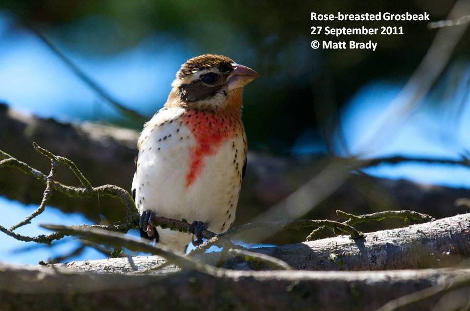
Unfortunately for us, we are experiencing one of the foggiest falls on record. In fact, since August 20th, when we first arrived, we have had 26 days with fog that obscured visibility to less than a mile. On the brighter side, that means 16 days when birds could find the island. Only a few of those days, though, had the right mix of visibility, cloud cover, and light winds to create small waves of arrivals.
In spite of the weather, we conduct two area searches daily (one in the morning and one in the afternoon) to find as many landbirds as we can. The observers cover the same five areas during each search: 1) the cypresses and tree mallow shrubs around the houses, 2) Heligoland [a recumbent pine and small hill], the old, decrepit water tanks, Shubrick Hill, and Twitville [an area with more tree mallow], 3) the Marine Terrace [an area of mostly dead, compressed annuals], 4) Corm Blind Hill, North Landing, and Little Lighthouse Hill, and 5) Lighthouse Hill. Standardizing the areas searched decreases the amount of variance in our data and ensures that we don’t miss much. During late August and September, warblers, orioles, vireos, and flycatchers are the groups that we primarily see.


We also conduct a shorebird survey during high tide, when many of the shorebirds gather together in flocks. Black Turnstones, Whimbrel, and Wandering Tattlers are the most numerous species we see because they like the rocky, intertidal habitat that composes our shoreline. But we also see a few other species such as Pectoral and Western Sandpiper and Red and Red-necked Phalarope.


No comments:
Post a Comment